
Multiple DEMs can be defined for a single coordinate system and the geographic area those DEMs cover might overlap.
The Application Serer supports querying the elevation of a specific position in on specific projected or geographic systems only. When querying the elevation of a specific position the Application Server will first check which DEMs of the selected projected or geographic system cover the position. If more than one DEM covers the position the Application Server will sort those DEMs first by the user supplied sequence number (ascending) and then by (descending) by its cell size.
This means that if the user does not sort the DEMs manually by supplying Sequence numbers the Application Server will automatically choose the DEM with the finest grid for calculating the elevation.
When checking the coverage of a specific position the Application Server will only check if that specific position is within the rectangular bounding box of the DEM. It might still be that the DEM internally does not provide elevation data for that specific position. Figure 1 shows an example: the blue areas in the image are areas that are covered by the rectangular bounding box of the DEM but do not provide elevation values.
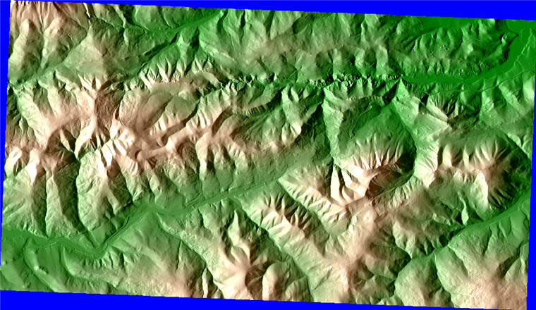
Figure 1: Visualization of a DEM (not done with Redbex). Blue areas are the areas not covered by the DEM
