
The DEM map tool provides the possibility to query the elevation of a specific point on the map, according to a digital elevation model stored with a specific projected coordinate system. You can activate this tool by selecting the DEM tool button in the Map View window's toolbar (figure 1:1).
This map tool will show a set of controls in the map area. First select the projected coordinate system in which you want to query the elevation (see chapter Digital Elevation Models for more details about digital elevation models in Redbex)
To measure the elevation of a specific point on the map select Point button in the map tool controls and click on the map. The elevation will be queried and will then be shown as a label on the map (see figure 1:3). If there is no DEM covering that specific point the label will show no coverage, if there is a DEM covering the point but the DEM does not include an elevation for that specific position not defined will be shown.
The labels for each measurement are temporary and are not persisted with the map view definition.
To remove labels select the Eraser button in the map tool controls (figure 1:3).
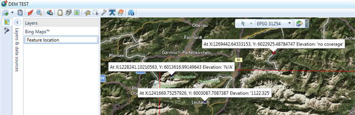
Figure 1: The DEM tool in the Map View window
