
The To-Scale PDF map tool provides the possibility to generate a PDF document that contains the contents of the map view and is in a user-defined scale.
You can activate this tool by selecting the To-Scale PDF button in the Map View window's toolbar (figure 1:1).
The Scale and DPI setting for the PDF to be created can be defined by the user. Scale can be a value between 100 and 1,5E08, DPI is a value between 5 and 300. Note that scale factor and DPI define the paper size of the created PDF as well as the size of the PDF in bytes. Several limitations apply for both sizes, see chapter To-scale map view PDF for more details.
Selecting Execute will start a job on the Application Server that creates the to-scale PDF file. The file will then be available via the Output files window.
Note: To preserve the scale when printing the PDF you will have to download the PDF and open it in a PDF viewer that that supports unscaled printing.
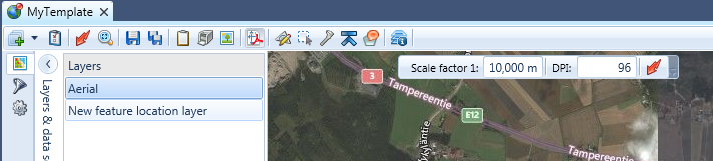
Figure 1: The To-scale PDF tool
