
On the base data tab the feature editor shows controls for displaying an editing feature identification data, base data and spatial data. Depending on the spatial support of the feature type and depending on the spatial system selected when the feature was created this tab shows also the control for spatial data.
Figure 1 shows the feature editor with the base data tab opened (in this case for a feature of type Inclinometer). Some base data is write protected ant therefore the controls are shown read only.
ID |
Id of the feature. This is a numeric Id assigned by the Application Server that uniquely identifies the Feature on the Application Server |
Created on |
This is date when the feature was created, i.e. when the feature was first saved on the Application Server |
Feature type |
The feature type of the feature |
Feature subtype |
The feature subtype of the feature. The subtype of the feature. While this control is read only the subtype of a feature can be changed from the Feature Explorer. |
Domain |
The domain this feature belongs to |
Name |
The name of the feature |
Description |
A description of the feature. |
Default senor |
This is the sensor that will be automatically used for newly created observations. Changing this has no effect on already existing observations. The used sensor can also be set manually fore each observation. |
Table 1: Base data shown on this tab in the feature editor
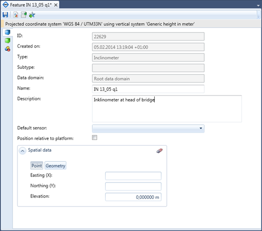
Figure 1: The Feature editor. Here shown with the Base data tab.
