Hydrology

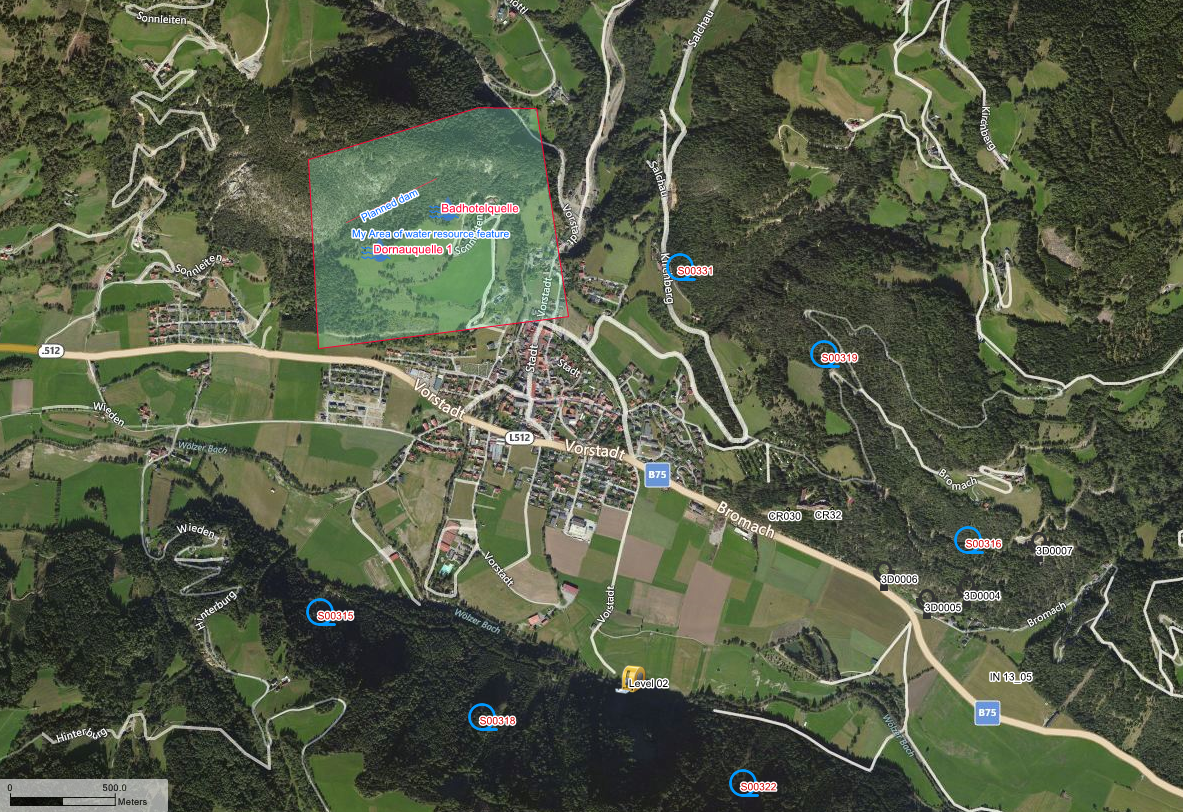
Monitoring the hydrological environment includes a wide range of activities like the monitoring of water in wells, ground water levels, flow rates of springs or lentic water, measurements of physical and chemical characteristics. Redbex provides many tools to manage and evaluate hydrological data.

Collect water level data, pumping data, chemical and physical parameters. Be it in the course of a construction project or as part of a general long term ground water monitoring, Redbex provides tools to help you organizing your ground water monitoring projects.
Monitoring the quality of water resources is crucial in many projects. Redbex helps you to collect all relevant data and provides tools to evaluate the data together with information from other experts. This way you can for example assess the influence of construction works on the quality of the monitored water resources.
Redbex helps you document and proof the influences a project has on the water resources. YOu can combine long term monitoring with short term observations, meteorological data and data from other areas easily.
Monitor all data relevant to springs from water flow to water quality and ownership. Use Redex presentation possibilities to get easy and powerful presentations of the monitored data.

Environmental monitoring

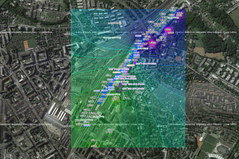
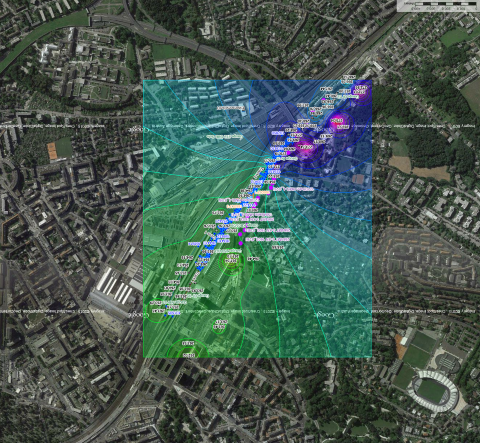
  • Combine your data visually with the integrated GIS

The field of environmental monitoring is extremely wide and therefor a prime example for the application of Redbex. The phenomenons monitored in this area are very diverse starting from simple air temperature, to air quality, to noise measurements and even to flora and fauna.

Redbex offers the possibility to manage data coming from all different expert areas to a single system, with the benefit of being able to evaluate data together, see influences and analyze correlations.
Redbex is able to deal with different data structures and formats produced in different expert areas ranging from simple numerical data to complex and nested data structures like geological documentations.
Redbex’ flexible presentation possibilities will ease the data handling in your projects significantly. Independent of the data you record Redbex’s presentation tools like maps, charts, reports etc. are always available to present data in an easy and understandable way.
Have all results been delivered at the right time? Does the quality of the monitoring results match your quality rules? Questions like this can be easily answered with Redbex. Versatile observation planning and data validation rules allow you to adapt Redbex to your legal and contractual environment.

Geotechnical and structural monitoring

With specialized data processing and data presentation tools Redbex is the perfect tool for a quick assessment of the geotechnical situation in your projects. The possibility to integrate your geotechnical monitoring data with data from other expert areas helps you managing your project.

Record and analyze all of your geotechnic measurements: 3D movements, distances, inclinometers, extensometers, strain, pressure, load etc. Use specialized evaluation and visualization methods to analyze and present geotechnical data.
Redbex has all the tools to collect and visualize 3D movements. Measurements on the surface are supported as well as measurements in a tunnel. Specialized tools within Redbex will evaluate and present the data different ways and allow getting a quick overview of the project’s status.
Redbex’s integrated GIS engine is of course capable to deal with data from 3D movement monitoring. Using contour lines, movement vectors and scaled point visualizations Redbex can help you to present and assess the results of your monitoring activities. Of course this visualization can also include other layers of information and are therefore perfect for integrative data evaluation.

Tunneling

  • Multi project support for big organizations

One of the challenges in tunneling projects is that it is a common effort of multiple disciplines including geotechnical experts, geologists, hydrologists, TBM-experts, surveyors and many others. Monitoring the various characteristics of a tunneling project before, during and after the construction works has therefore become big challenge for the project personnel – Redbex is the one stop shop for all your data management requirements.

While Redbex is surly not the only software product that will be used in a tunneling project it forms a roof over all your data and is the point where every expert can access all the valuable data for managing the driving works, assessing the risks and planning the next steps.
Redbex scales easily from small projects to the biggest tunneling projects it is able to deal with millions of observations and hundreds of users. The mighty framework of Redbex allows you to configure the software to meet the specific needs of each of your tunneling projects.
Redbex provides the possibility to manage the data of hydrological monitoring projects and provides the means to analyze the hydrological environment. Be it a monitoring project before, during or after construction works, monitoring projects for hydrostatic modelling, or some other hydrological or hydrological monitoring project, Redbex has the means to ease the management, processing and presentation of your hydrological data.
  • Surveying subsurface
  • Surveying on surface
  • Geotechnical monitoring
  • Hydrogeological monitoring
  • TBM data
  • … and many more

Other application areas

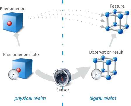
The power of Redbex lies in the ability to manage data produced by nearly any kind of sensor (including the ‘human’ sensor). The core of Redbex is built on the ideas behind the SWE (Sensor Web Enablement) standards and is therefore built to be universally applicable.

A multitude of generic structuring, processing and presentation possibilities make Redbex a software that can be used in countless application areas. Domain specific add-ons are available for the specific needs of expert areas.

The result of each measurement of a sensor is the data in a specific structure. In Redbex different data structures for different sensors are available as plugins. Therefore Redbex can adapt easily to new data structures and nearly all kinds of measurement can be recorded.
The data presentation capabilities of Redbex are designed to be totally independent of the underlying data. I.e. you can use all the provided presentation capabilities (maps, charts, reports, etc) with any kind of sensor data.
Redbex includes a Web Services API that can be utilized to integrate Redbex into your software environment.
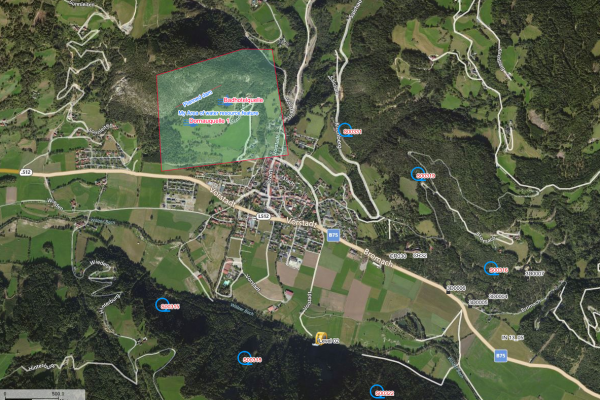
  • Locate your data and evaluate spatially